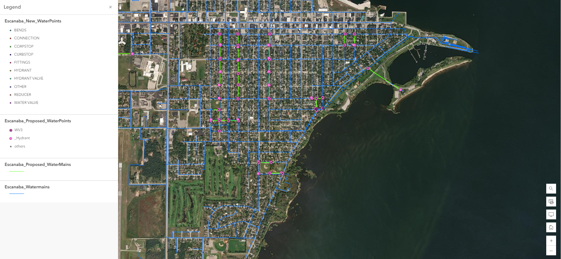
How GIS Can Improve Your Lead Service Line Inventory and Capture Project Funding
Lead is present in municipal water pipes throughout New York and the entire country, but technology is making safe water possible faster.
Podcast: Tracking Community Assets with GIS
Imagine a tool that tracks any feature in your community—whether that’s a lead waterline, a tree, a fire hydrant, or a building. What might that mean for your community? How much better could you plan for development or budget for improvements? What if, with the click of a button, that tool could help you communicate better with residents, secure funding, or share knowledge with a successor? What if that tool already exists and it’s affordable?

GIS in Action: Clarkson Grad’s Role in Campus Optimization
In the fall of 2023, a senior at Clarkson University saw an opportunity to bridge his studies, career, and alma mater, and he took it. Patrick Hayes, now a Clarkson graduate, became C2AE’s GIS intern. Patrick’s responsibility was to assess room after room of Clarkson’s

Three New Answers to Age-Old Public Works Questions
“Public works” is a broad term that can be difficult to define. In general, C2AE believes public works is about fostering vibrant, healthy communities.
